Tag Archives: beach

Murchison, Westport and a Swing Bridge

Our destination today is Westport, but we stop several times on along the way.  About an hour into our drive we pull over at the Hope Saddle Lookout.  We knew we would have wonderful views as we had been winding all around the mountains and through the forest.  The clouds were hanging low and dancing around the peaks.

This spot is famous for saving over 30,000 hectares of forest as the NZ government made an accord with the logging companies.

A sweet little church popped up seemingly out of nowhere.

Murchison and NZ Longest Swing Bridge

We arrive into Murchison which is the home to New Zealand’s longest swing bridge.  It is 110 meters long and is suspended 172 meters high over mighty the Buller Gorge.

We were lucky, there were not a lot of tourists here when we arrived.  We paid $10NZD per person and eagerly headed toward the bridge.  It was a fairly calm day, not a lot of wind so the only swinging came from our own weight.

The views were beautiful from the center of the bridge.

When we got to the other side, we discovered several trails that led to a beach and Ariki Falls.  Super easy walks that led us to beautiful places.  The top left photo shows the flood mark in 2021 – check out the white arrow – it is well over 2.5-3 meters tall.

The Ariki Falls were a really nice diversion and oh so pretty.

This is also where they did a lot of gold mining in this location.  They had a replica of a house used by the miners.

Westport

We arrive into Westport about 6 hours after we left Nelson.  It is a nice little beach town.

We enjoy a nice lunch at Donaldo’s and then head to Carters Beach Seaside (our hotel).  Next we drop our bags and make our way to the beautiful, and very long black sand beach.

We then head to Cape Foulwind where there is a nice hike to a lighthouse.  Yep, you read that right, “Cape Foulwind” and it is very obvious why this town got its name once you arrive….yuck!

This photo shows the original wooden lighthouse that was built in the late 1800’s and to the right is the newer digital, unmanned lighthouse.  I like the original one better.

Pretty views from the base of the lighthouse.

Just 5km down the road is the famous seal colony located in Tauranga Bay.  To my surprise, there really weren’t that many seals – maybe they were all out hunting.

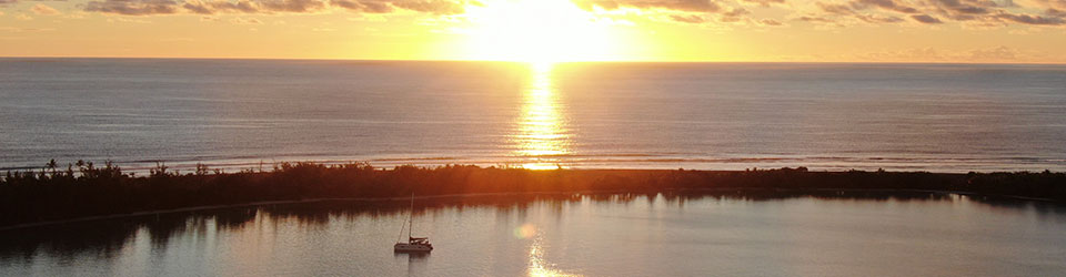
We ended our day with a bottle of rose on the beach at sunset.  I’d say this was a good day!

  • Travel:  210km
  • Hotel: Carters Beach Seasisde

Events from this blog occurred during the last week of February.  Our blog posts run 10-12 weeks behind live events.  Check out the Abel Tasman Caves in our last blog post.

Sugar Shack alone at Bahia Llucio

El Mar: The Good, The Bad, and The Ugly

El Mar, the sea, the ocean, the Pacific.  All the same, a challenge.  Must admit, it has been a bit frustrating traversing across this side of the ocean.  Perhaps it is our route and I am being unfair, but gesh!  The majority of our days sailing down the coast of Chile have been with the wind and current on our nose.  We can figure out how to deal with that, but then you couple those conditions with the swirly seas and it becomes downright uncomfortable.

Please refer to the “live blog on 21 February 2019” as I don’t want to be repetitive.

The 600nm trip from Quintero to Valdivia should have taken us between 5-6 days.  We padded it a little as all of our trips have taken longer than expected with the stronger currents and weather conditions.

Early on the 4th morning, we were seeing almost 2 knots of current and over 20 knots of wind pushing against us.  El mar was so squirrely that our auto pilot could not hold our course.  We had a choice.  We could either keep our heading and make it to the next safe harbor 60 miles away.  At our speed it would take us 2.5-3 days.  Or we could turn around, backtrack 40 miles and hide out in Bahia Llico.  We decided to backtrack.

Bahia Llucio

Bahia Llucio is a one horse town. Well, not literally, but there are only about 4-5 streets, 3 small tiendas, 6 restaurants, and a fish market.  We walked the entire town in 10 minutes.  However, they do have a magnificent, long beach peppered with lovely little sea shells, crabs, clams, and muscles.

The bay is surrounded by lush, green trees which is a stark difference to its Northern towns.  Fishing boats are pulled in and out to sea using a tractor and a dozen dogs are your welcoming committee.

Bahia Llucio Anchorage

Bahia Llucio Anchorage

It was cold, so we were in full cold weather gear when we went to shore.  The pack of dogs followed us on our walk down the beach.  A small herd of cows were sun bathing, but would have nothing to do with Matt.

Bahia Llucio beach walk

Bahia Llucio beach walk

We hit out in this bay for 4.5 days before a weather window presented itself.  We had 180nm to conquer against the wind, waves, and current.  El Mar was cooperating as we were leaving.  The trip started out decent enough, we had a double reef in the main for about 12 hours before taking it down.  But then, el mar started to mimic a washing machine cycle making it a really uncomfortable ride.  We forged ahead and arrived at the Valdivia mouth at dawn.  A short 2-miles up the river and we arrived at Club de Yates Marina Estancilla.

Valdivia - Club de Yates

Valdivia – Club de Yates

Some fun photos.  Matt surrounded by his computers and charts, sunset and sunrise

Matt navigating from inside

Matt navigating from inside

Sunset at sea

Sunset at sea

Sunrise at sea

Sunrise at sea

This is what it looks like when a fishing boat encroaches on your space.  Of course, this only happens at night.

Close encounter at sea

Close encounter at sea

TRIP 1 – Thwarted and had to backtrack

  • Total miles – 377
  • Total hours – 76
  • Max Speed – 11.1
  • Average Speed – 4.9

TRIP 2 – Continuation to Valdivia

  • Total miles – 199 nm
  • Total hours – 40.25
  • Max Speed – 8.3
  • Average Speed – 4.9
Birds enjoying a day at the beach

Las Perlas Archipelago: Part II

The beauty of the Las Perlas Archipelago is that if you don’t like one island, you can easily move to another. Isla Pedro Gonzales was lovely, but with the odd rubber smell and loud music we decided to move to a new island. Isla Viveros lies only 8-miles away from Isla Pedro Gonzales so we motored on over. Our friends on “Breakaway” told us to stop short of Isla Viveros at a set of small islands called Isla De Feunche.

At first, it looks like 3 small islands, but in reality, it is one island. During high tide, the rocky path  between each rock is covered by water, but you can see the path during low tide. Sunsets were stunning here!

The beautiful islands of Isla de Feunche

The beautiful islands of Isla de Feunche

Another blissful island, isolated, serene, gorgeous, and full of wildlife. We had it all to ourselves and enjoyed every minute of it! We took the SUPs out and paddled to the main island and enjoyed the beach, skipping rocks, collecting treasures, and playing with the fish.  This is a gem in the Las Perlas Archipielago.

IMAGE: Top Sugar Shack at the anchorage by herself, Middle: Our SUPs hanging out by a tree, Bottom: Matt watching the stingrays in the shallow water.

A day at the beach...

A day at the beach…

You can almost make it around the entire island…

IMAGE: Top: Matt claiming a spit of sand & a heart rock, Middle: Climbing over rocks exploring the island, Bottom: Me on my throne and rocky shore.

Isla de Feunche

Isla de Feunche

We received word that our batteries arrived earlier than we expected so we had to rearrange our Las Perlas schedule a bit. We were heading to Isla Bayoneta forcing us to leave our little piece of paradise – we loved Isla De Feunche!

Bayoneta is sandwiched between Isla Malaga and La Vivienda. We heard that it was a really pretty, quiet island. It was a nice anchorage, but with another boat already here we decided to go somewhere else. Way too crowded. (Yes, we are a bit spoiled)

We had a few choices of where to go next. We could return to Contradora where we’d have wifi (always good), go to the Eastern side of Mogo Mogo, or go to a new island called Isla Pacheca. As we motored north, we decided against Contradora as we had already been there. We swung into the new anchorage at Mogo Mogo which was pretty but crowded with 4 boats. So, we continued on to Isla Pacheca.

Really pretty anchorage, no other cruising boats, pretty little beach, and well protected from the sea. When we arrived, there were several fishing boats cleaning their days catch, but as the afternoon progressed, more boats arrived. Not a big deal as we knew they would leave, but there was a horrible fish smell and tons of birds.  The birds are wonderful, but the bombs they leave are not.

Isla Pacheca beautiful, but a place where local fisherman go to clean their catch.

Isla Pacheca beautiful, but a place where local fisherman go to clean their catch.

We spent more time cleaning under the boat. Matt got the hooka out and cleaned the Starboard hull (below the waterline) and replaced both sets of small zincs which were shot to hell.  Image below shows two small zincs and one new in the middle.  We got our money’s worth for sure.

Old and New Zincs

Old and New Zincs

While Matt was under the boat, I scrubbed the teak on both sets of sugar scoops. We had applied several coats of stain over the years. It was time to strip the wood back and either reapply the stain or apply an oil to protect the wood from the harsh sun. First step, is cleaning the dirt and stain out of the wood.

We got up early, pulled anchor, and were on our way by 0600. Our goal was to be at La Playita by 12n which would give us 6 hours to travel the 40+ miles. We will collect our batteries, clear out of the country, do laundry, and a few more provision runs. Hopefully, we can get out of there within a few days.

The Las Perlas chain has been a delightful experience!  So many beautiful, tranquil, and untouched islands.

Passage from Las Perals to a Playita:

  • Uneventful, luckily
  • Few dolphins came to play with us
  • No fish jumped on the hook
  • No whale sightings
  • Very litle wind