Tag Archives: tonga

Voyage: Tonga to Fiji

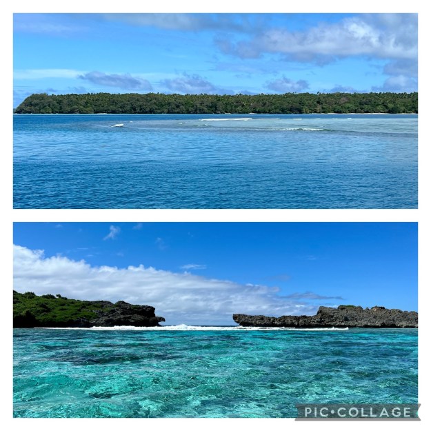
It was with a heavy heart that we decide to leave Tonga a week earlier than planned.  As it was, we were only allowed 4 weeks to explore dozens of islands.  Sure, we could have extended our visas, but we really needed to pick up our second hand rudder – so we had to leave at the first “decent” weather window.  Our voyage had a rough start.

We left the Neiafu mooring field (main town in Vava’u, Tonga) around 0730.  Our forecast had light 10-12kts of wind from the southeast, moderate 1-2m seas, no cape, but a constant rain.  It was not the best weather window, but it was good for us as the winds put us in an angle where we could use our starboard rudder.  Remember we are still operating with only one rudder.

Matt decided to put up full sail (both the main and genoa) because the winds were “light.”  However, as we were exiting the Faihava pass a storm popped up and gave us winds coming from multiple directions.  Auto pilot could not control the steering with one rudder and we quickly jumped to hand steering until we got outside the pass.  Once we had more room, we rapidly reefed the main and genoa.  So much for the forecast!

There was a large group of boats that decided to leave with us.  Some were going to Vanuatu, some to Fiji and others were headed west.  It only took a few hours before we lost sight of all the boats.  We could still see some of them on AIS, but there was no visual with the naked eye.  The images of the orange boats and white boats are all leaving Tonga.

The Voyage

I took stugeron (sea sick pill) but I failed to put on my transderm patch.  Why do you ask?  I did not think I needed it since we had light winds in the forecast.  Silly me!  I tried to weather through the crappy feeling, but 3 hours later I succumed and put the patch on.  The seas coming from the SE hit our aft side of the boat causing us to rock funny and that did not sit well with me.  But after I put the patch on I felt better.

On our first day we averaged 7.1kt with a max of 13.7kt as we surfed down a wave.  We traveled 175nm on the first day of our voyage.

It was gloomy and drizzly the entire day.

We had to constantly manage our sail trim with these big seas.  Auto pilot would easily get overpowered with a rogue wave changing our course from 290T to 240T in a blink of an eye.  

Day 2

We tried to fly our parasail as the winds were deaddown.  It was a super sporty ride and we were making great time with boat speeds hitting 9-11kts!  However, the waves would cause us to surf and the additional speed put too much pressure on the sail.  So we took her down after only a few hours and put our genoa out.  Speeds decreased from 9-11kts with the parasail to 5-7kts with the genoa.  

As luck would have it, we entered Fijian waters at night which was not ideal.  But we have great charts and satellite images which kept us safe.  The photo below shows us (red boat) on a trajectory through the island and reefs.

We tried very hard to arrive to the Savusavu channel before dark, but we fell short by 45 minutes.  The channel is narrow and has boats on both sides.  With one rudder and limited mobility, we decided it would not be wise to enter in the dark so we dropped the hook at Custeau Resort for the night.

Overall Trip Details:

  • Total Travel Time:  60hours
  • Total Miles Travelled:  413nm
  • Average overall speed: 7.1kts
  • Max Speed: 14.7kts
  • Engine Hours used:  Port: 5 hours and Starboard 16 hours

We ended up using our starboard engine more to compensate for the missing rudder.  But overall we were able to sail the majority of this voyage.

The next morning we got up early and made our way into the channel.  Copra Shed Marina sent Pio out to assist us with the mooring which was so appreciated!

Our blog posts run 8-10 weeks behind actual live events.  This blog occurred mid-August.  Did you read our last blog, “The Majestic of Kenutu.”

The Majestic Cliffs of Kenutu

Our last anchorage in Tonga was a spectacular one!  We picked this remote easterly island based on its location for the upcoming winds.  Plus, we wanted to hit one island on all four sides of Vava’u.  The winning island was Kenutu.  This is a long, pretty flat island with several white, sandy beaches and a thick forest inland.

It can be a bit of a challenge navigating to Kenutu because of all of the reefs.  We had to ensure we had good visibility and updated satellite charts to make it safely, which we did!

Kenutu, Tonga

Kenutu, Tonga

We arrived around 1500 which did not leave us much time to explore before dark descended upon us.  So, we jumped in Sweetie and worked our way through the reefs near shore.  A friend of ours told us that there is a 10-minute walk to the other side so we decided to investigate.

Exploring Kenutu

The path was easy to find as someone put a float in the tree with “trail” hand written on it.  Easy enough.  The first trail we found was truly a 10-minute walk to the other side.  But what we saw shocked us!  The colors were so vibrant!

The rocky cliffs shouted out with bright reds, browns, and greens while the water below had dozens of variation of blues and greens.  I loved watching the waves come up over the table creating a shallow pool.

Another beautiful hillside with more colors.  We found several trails on the east side of Kenutu.  We walked on all of them that we could find.  Each bay was just as beautiful as the last.  One of our walks led us down to sea level where we could witness the blow holes and surf up close and personal (lower photo).

One bay had several blow holes that showed off in a spectacular fashion.  I could have sat here and watched this fierce display of water all day!

It was getting dark and we wanted to explore by dinghy.  We went around the southeast side of the island and found a lovely pass.  But it was too rough and too shallow for us to go through by dinghy.

If we had more time we would have certainly stayed at this Kenutu anchorage longer.  What a beautiful surprise it was to see this island.

The next day we had to pull up the hook and go back to Neiafu to clear out of Tonga.  Super sad as we really did not do the Kingdom justice in 3 weeks.  I would love to come back here and really explore all three archipelagos.

This blog occured in mid-August 2023.  Our blog posts run 8-10 weeks behind actual live events.  In our last blog I share details of Vava’u.

Uoleva

Uoleva: The Island of Walks

Uoleva is a beautiful “w” shapped island that has a 6-mile, white, sandy beach that surrounds it.  In the center is a lush forest full of palm trees and thick vegetation.  There are no markets, gas stations, roads, churches, cell towers, or modern conveniences.  Three small resorts (20ppl or less each) and a kite surf school are based here.  But it is not easy to get here.

Guests usually fly into Fiji, then into Vava’u, then into Lifuka.  From there, the guests are shuttled in a boat for 20-minutes to Uoleva.  You have to really want to come here.  But once you are here, you are in a true island paradise.

Each resort offers a variety of packages including room and board.  They have generators, solar, wifi, water tanks and made lovely conveniences that make your stay comfortable.  We visited Serenity and Sea Change. 

Getting to Uoleva

We had a 35nm sail from Tanoa to Uoleva.  It was another light wind day so we decided to put up our medium spinnaker.  She needed to dry out a bit anyway and we were not in a big hurry.  Can you see that we are going faster than the wind?  I love when that happens (thanx to the sea surfing us down a wave).

Along the way, we had several whales swim near us and show us their best tricks. I love the tail wave and the flipper wave.

Anchorage

We decided to anchor somewhere different than most boats.  Most boats anchor in front of the resorts but we decided to anchor on the other side so we had a lovely view of the towering palm trees over the sandy beach.

We had a fantastic sunset on our first night.  

6-mile Loop around Uoleva

The next day we decided to walk around Uoleva.  We left at low tide with some water and our flip flops.  We knew it would be a long walk, but truth be told, I had no idea it would be 6 miles!

Most of the walk was on a soft, sandy beach.  There were a few areas where we had to walk on the limestone, coral rocks and or jump over or crawl under fallen trees (from the tsunami).

Walking 6-miles is not that big of a deal to us, but walking 6-miles in soft sand makes you work!  I ws exhausted and so ready for a cold drink and a chair.

We found a couple of short cuts that take you from east to west (or visa versa).  One even tempted you with a sign that said “beer.”  But we did not succomb to our desires for a cold beverave, we kept going around the island.

We ended up at Serenity Resort.  We asked three people for a cold drink of water and a beer for Matt.  They are not used to outsiders coming for food or drinks so we certainly confused them.  They did serve us but it was not customary.  So, we moved on to Sea Change Ecco Resort which happily offered us a Tongan cocktail and cold beer.

We were pretty darn tired so headed back to the boat and enjoyed another lovely sunset.  This is the Koa volcano in the disrtance.

Sea Change Ecco Resort

Not sure if you remember, but a year and a half ago I met this woman named Krista on a whale watching tour.  She lives in Hawaii and works with marine animals for a living.  We kept in touch and to our surprise, we were both going to be in Tonga at the same time!  So, we made plans to visit her at the Sea Change Ecco Resort where she was working giving whale tours, massages, and doing generally anything and everything around the place.

She gave us a tour around the resort and then we caught up over a cold drink after our walk.  She is so fabulous and nice!

The owners Clint and Maria live in Auckland when they are not living here in Tonga running their beautiful little resort on Uoleva.

This blog occured toward the end of July 2023.  Our blog posts run 8-10 weeks behind actual live events.  In our last blog I wrote about the small bump in the pacific ocean called Tanoa.