Pacific Passage to Easter Island

Matt dutifully posted “Real-Time Pacific Passage blogs” while we were at sea.  So, I will not bore you with another rendition of the same passage, but I will give you some highlights.

Technically, this is part II of our Pacific Passage as we started from Valdivia to Robinson Crusoe (500nm) and now from Robinson Crusoe to Easter Island.

The anchor was pulled up at 1030am on 16 March with approximately 1625 nm to Easter Island from Robinson Crusoe.  We anticipated it taking 12-14 days to make this trip.

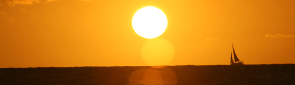
Sunset Photo

Sunset Photo

A few days we averaged 170 nm a day, but for the most part we averaged 130-150 nm a day.  At the end of the trip we sailed 1,655 nm with a max speed of 13.2 and an overall average speed of 6.2. A remarkable 11-day sail with decent winds.

The only disappointing mishap was a ripped spinnaker.  We were flying our small spinnaker which is good to 20kts of wind.  A squall snuck up on us and as we debated taking it down, POP!

Picture of Spinnaker happy and flying

Spinnaker happy before she wasn't

Spinnaker happy before she wasn’t

Matt and Spinnaker unhappy

Ripped the clew right off the small spinnaker

Ripped the clew right off the small spinnaker

We were thrilled to sail up to Easter island are so looking forward to exploring this mystical island.

This map gives you an idea of where we sailed from Valdivia, to Robinson Crusoe, to Rapa Nui.

Robinson Crusoe and Easter Island

Robinson Crusoe and Easter Island

Passage Hao to Tahiti #01

Well we are on the move again. We enjoyed out time in Hao, but it was more utilitarian than exploration. Hao had decent internet a big pass into the atoll and supposedly some great snorkeling / diving at the pass. Well we took advantage of the internet, and since we followed the supply ships in when we arrived loaded up on some fresh fruits and veggies.

The utilitarian part was ordering some parts for Christine’s trip back to the US, to make sure they arrive on time. As well as a few trips to the local hospital. A bite or scratch on Christine’s leg wasn’t healing so we sought the advice of the professionals, and they got her well on the mend. We stayed a few days longer to make sure it was going to mend, letting the doctor/nurse follow up. Its looking good, so we decided to move on to Tahiti.

Moving on is not without its challenges. Saying good-bye yet again to new friends, and the biggie this time was raising the anchor. The anchor alarm/watch had a really tight circle pattern, much too tight for the amount of chain we had out in the deep water, so we planned on a lengthy process. Really weren’t sure what to expect. We knew the wind had shifted us 360 degrees more than once during our stay, and we had anchor floats on the chain since we really couldn’t see the bottom in 17M of water. Turns out we snagged some old rebar forms some 8×8 feet square, and 2 of them at that. With that on the chain and anchor we didn’t stand a chance of moving. Cutting the ropes that held them together and we were able to pull the rest of the chain up, course the whole process took over an hour.

These atolls have entrances or passes, that is how the water gets in to them as well as the boats. So you have to time your passages to coincide with ‘slack tide’. The anchor fiasco, even tho we allotted extra time we were late for what we thought was the definition of slack tide. Wrong, but at least it was an outgoing current. We entered the pass with 6 knots of boat speed, with the current our speed topped 12.5 knots. What a crazy ride, over the shallows and current pushing every direction. We made it, the boat that was coming out behind us decided to wait and try tomorrow. There were some pretty big waves as the current gushed over the shallow spots, we continued till we were well clear of the currents and raised the sails on our way to Tahiti.

The forecast is for light winds for the first 2 days then filling in some. That being said we have 9 knots of wind and we are cruising along at 7 knots of boat speed. We started out heading south around the 2 closet atolls in our path, but then the wind came more out of the north so we are now going north around Marokau and Ravahere.

Planning on 4 or 5 days till we arrive in Tahiti, lets see if I can remember to send a ‘we arrived’ update as I tend to forget when the hook is actually down.

470 of 498 miles left to go.
[realtime]

At 5/30/2019 @ 5:52 AM UTC
Our position: 18°03.06’S, 141°23.07’W
Traveling 5.6 heading 283T

Google says we are here
www.google.com/maps/place/-18.05100,-141.38450

=====
This message was sent from an amateur radio account. If you reply, be mindful that your reply will be subject to inspection by the public. If your reply contains prohibited content (profanity, personal or commercial business information, etc.) it may not reach its destination, and will endanger your correspondent’s license. Ask your correspondent if you have any questions.

Robinson Crusoe Hike to Selkrirk's Mirador

Adventures on Robinson Crusoe

There is a lot to see on this small island named after the famous storybook legend, Robinson Crusoe.  This blog is dedicated to the highlights of our adventures.

SELKIRK’S MIRADOR

Alejandro Selkirk walked barefoot for two hours each day to reach a look out that gave him views of a great portion of the island.  Here he would watch the horizon for ships to rescue him.  There are two memorial plates of Selkirk’s adventure that can be found on this path.  The first was left by officers from the British ship Topaza and the other by a direct descendant of the Scottish corsair.

We had a lovely guide who joined us on our exploration.  About 15 minutes into our hike, a large, black, furry dog nuzzled my hand and took the lead.  It was absolutely amazing.  He showed us exactly where we needed to turn and which fork in the road to take. Crazy fellow would also wait if one of us lagged behind.  Usually, I was lagging behind, having difficulties catching my breath.  He would lead Matt up the path and if he did not see me coming behind him, he would come get me.  Truly a sweet, good natured pup.

Selkirk's Mirador Hike

Selkirk’s Mirador Hike

About half way to the first monument, we came across remnants of Alejandro Selkirk’s house.  He had one house in a cave facing the main bay and another more protected more inland.  The second one is what we found on this trail.  Basically, stones of the foundation, but the location was protected yet breezy.  The last photo is the crazy dog digging for bugs.

Selkirk's House Remnants

Selkirk’s House Remnants

Finally.  Reached 1st of 2 Mirador’s

We reached the first memorial just in time to take advantage of the gorgeous view and cool breeze.

First Mirador on hike

First Mirador on hike

Another 45 minutes up the hill we reached the 2nd memorial which is where Alejandro would go each day in search of rescue ships.  Amazing view of two sides of the island

Selkirk's MIrador View of two bays

Selkirk’s MIrador View of two bays

Along the path were wild blackberry plants.  Matt had a field day picking and eating fresh berries.  The top left photo is a picture of the bay where you can just barely see Sugar Shack.  The bottom right photos shows you the location of the two memorials

More Amazing views from Selkirk's Mirador

More Amazing views from Selkirk’s Mirador

On the way back into town we stopped at a restaurant for cold beverages and learned this was the home of our tour guide.

Selkirk's Eatery

Selkirk’s Eatery

SELKIRK’S CAVE

We so badly wanted to visit Selkirk’s Cave. But alas it was not in the cards.  The only way to access this cave is by boat and then up a craggy path.  The tourist season on Robinson Crusoe island was December – February.  We arrived the middle of March.  So, no tourist boats to take us to the cave and it was a bit too far and too rolly for Sweetie.

FORTRESS OF SANTA BARBARA

Fortress of Santa Barbara is a national monument in the center of town.  It defended the Spanish against pirates during the 18th century.  There is a small piece of the original wall which stands strong and several cannons that remain.

CEMETERY OF THE ISLAND

I know it is weird, but I really enjoy visiting local cemeteries.  The local island cemetery is very small, which is not surprising considering there are only 500 inhabitants.  But the really interesting thing about this cemetery is that there are graves of some sailors from the Dresden as well as he Baron Alfredo de Rodt’s.

Cemetery and Fortress

Cemetery and Fortress

PATRIOT’S CAVE

Located next to the fortress are seven caves that were sad shelter for the patriots of the Chilean Independence.  They were banished in 1814 to Robinson Crusoe and did not fare well in these caves.  Some of the caves had enclaves for cooking, but most were nothing more than a massive hole in a rock.

Patriot's Caves

Patriot’s Caves

CANNONBALL DESTRUCTION

Just above the rocky shore is a large volcanic wall.  Embedded into this rock wall are four cannonballs that were fired during the Dresden attack.

Dresden Cannonball Attack

Dresden Cannonball Attack

PLAZOLETA DEL YUNQUE

A beautiful and moderate hike took us to Plazoleta dely Yunque (little square).  At this spot you can still see the remains of Hugo Weber’s home. Hugo was a sailor of the Dresden and hid from the rest of the world 12 years.  He was later accused of being a member of a network of espionage of Canaris.

Plazoleta dely Yunque

Plazoleta dely Yunque

EL CAMOTE

A well built, wooden path is ust beyond the Plazoleta that leads you through the forest with lovely, endemic flora and fauna.

We really enjoyed our short visit to Robinson Crusoe.  The island had great history, friendly inhabitants, and beautiful landscape.  A wonderful stop in our travels.