Tag Archives: new caledonia

Ile des Pins Unusual Characteristics

The arresting, tall, narrow, crooked pines called “Araucaria Columnaris” are endemic to Ile des Pins in New Caledonia.  These quirky pines grow rather fast and can reach heights of up to 60 meters (196′).

This unusual tree has many names including: the Cook Pine, Columnar Pine, Coral Reef Araucaria, New Caledonia Pine, Columnar Araucaria, and Cook Araucaria. 

I was on a mission to see these interesting trees up close and personal.  We came to shore and started on a loop walk along the “Sentier” path.  It is an easy, flat walk of about 3.5 miles around two bays.

The path is very well kept with some areas walking across wood planks and dirt paths.  

The entire way weaves you through the forest, mangroves, and magnificent pine trees along the coastline.

The pines here in Isle des Pins have short, mostly horizontal branches that grow in circles around a narrow trunk.

The branches are long and skinny with a triangle, scale like needles.

The female cones are 6″ long while the mail pollen cone are only 2″ long.  It was super odd that we could only find 2 cones on 4 walks over 4 days!

These are baby Columnar Pines.

Unusual Characteristics

One of the most unusual things about the Columnar Pines is that they grow crooked.  Their crooked nature and soft wood leaves them to be undesirable to loggers.  However, they are perfect for pirogues or dugout canoes that the locals use. 

Another unusual trait is the paper-like bark that peels away from the trunk in small thin sheets.

It’s like it sheds its skin over time exposing fresh new bark.

The Ile des Pins are truly beautiful and breathtaking.  

The lucky pigs that get to live in the beautiful forest.

Our blog posts run 7-8 weeks behind actual live events.  We were in Ile des Pins toward the end of June 2026.

Find Ile des Pins on No Foreign Land.

What made Captain Cook stop and stare?  Find out in our last blog post.

Matt Lands on Ilot Mato

Our new destination is Isle de Pines which is about 80nm from where we are anchored (MB’e Kouen).  In order to get there we have to head southeast which is directly into the tradewinds.    So, we waited for a really light wind day and headed in that general direction with the plans of stopping at an island named after Matt – Ilot Mato.

We decided to break up the trip into a few days as opposed to doing an overnight.  So, our first stop will be Ilot Mato which is about a 39nm trip.

From the map below you can see the many reefs surrounding the tiny little island of Mato.  Matt expertly maneuvered the boat to the anchor spot.

We anchored around 3:00p and quickly hopped in the dinghy to explore ashore.

Ilot Mato

Ilot Mato

A Snake Filled Mountain

We learned that there was a “trail” to the top of the mountain.  We found the “start” which was a little sketch as it was totally overgrown.  

It wasn’t that this was a particularly steep incline as it was only 150′ to the top.  And it wasn’t that it was a long hike as it only took us 40 minutes (up and down) and was a mere .4 miles. 

But what was difficult was the fact that the “path” was incredibly overgrown, you could not see the ground, there are huge holes all over the place, the ground caves in, and there are poisonous snakes!  Yep, snakes!

Just when you think you put your foot on solid ground it gives way and you land inside someone’s living room.  Thank goodness there were no occupants in any of the holes I fell through!

The views of the anchorage were lovely.  You could see the reef jutting out from the island to the anchorage.

This view almost makes the hike worth it – “almost.”

Our blog posts run 7-8 weeks behind actual live events. 

We were in Ilot Mato toward the third week of June 2026.

Find Ilot Mato on No Foreign Land.

Be sure to check out the beautiful Ilot Kouen in our last blog post.

M’Be Kouen: White Sand Ilot, Bordered by a Reef

A little slice of paradise, Mbé Kouen is a small island of fine sand, bordered by a pretty reef in the middle of a turquoise water.

Photo courtesy of Jaqui Sparks, Wainani from the airplane.

Photo courtesy of Jaqui Sparks, Wainani from the airplane.

This little Ilot is surrounded by a reef which is then surrounded by another reef.  So, how do so many sand dollars make their way on to the beach?

On a light wind day, we sailed from Ilot Signal to Ilot MB’e Kouen.

We were the only boat in the anchorage and had this beautiful spot all to ourselves.

Of course some remoras and squid considered it their home first.

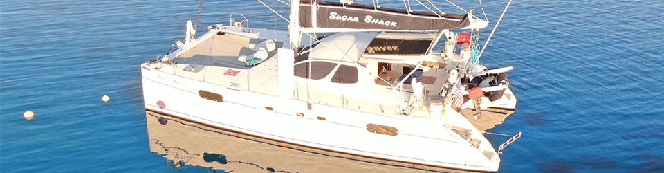
Matt got the drone out to show off this beautiful anchorage.

Ilot MB'e Kouen

Ilot MB’e Kouen

We are actually inside a reef (where Sugar Shack is anchored).  And yet, there is another reef around the little MB’e Kouen Island.

Do you think they can see the smiley face from out space?  

Ashore at MB’e Kouen

We took the dingy ashore which was fairly easy. 

There is a light blue water way from the anchorage to shore.  We dropped the hook, scared off a flock of birds and started exploring.

This little spit of sand seemed to be a grave site for tons of sand dollars. 

Most of these beauties were broken, but a few found their way back to the boat.

This really is a beautiful spot.  Perfect lunch spot.

Our blog posts run 7-8 weeks behind actual live events.

We visited MB’e Kouen toward the end of June 2026.

Find MB’e Kouen on No Foreign Land.

Be sure to read about how Signal Island got its name in our last blog post.