Tag Archives: lighthouse

Ilot Signal

Ilot Signal: A Tiny Island with a Big History

At first glance, Îlot Signal looks like the kind of island that belongs on a postcard: white sand, turquoise water, and just enough palm trees to make you question every life decision that didn’t involve becoming a beachcomber.

Photo Courtesy of Wainani 2026.

Photo Courtesy of Wainani 2026.

This nature reserve is an easy place to access and a hard place to leave.

The South Province installed (18) moorings for visiting yachts and launches.  This preserves the seabed and maintains a healthy sea life.

Photo Courtesy of Wainani 2026.

Photo Courtesy of Wainani 2026.

How did Ilot Signal Get its Name?

But this tiny island, about 13 nautical miles from Nouméa, has an important history. Long before GPS and chart plotters started doing the heavy lifting, Signal Island served as a crucial navigation marker for ships entering the lagoon. In fact, its name comes from the signal mast that once helped guide vessels safely through the reef-strewn waters.

The island’s namesake signal tower still stands proudly above the palms, keeping watch over the lagoon much as it has for generations. Before satellites and electronic charts, this marker helped ships find their way through the maze of reefs protecting the coast. In the early 1880’s a 10m high triangular pyramid made of wood and coral was built to serve as a signal for ships heading into port.

In 2004, the remains were classified as a historical monument.

Today it serves as both a navigational aid and a gentle reminder that sailors once crossed oceans armed with little more than charts and courage.

A Walk Around Ilot Signal

There is a long, sturdy dock jetting out over the water that locals use to drop off guests.

Ilot Signal is a popular spot for locals as it is so close to Noumea. 

The island offers some of the most spectacular snorkeling and white sandy beaches in the area.

There is a lovely path that takes you around the entire island (about 1.5miles).  It is well maintained and easy to follow.

During one section, the locals have built a wood walk way that winds you through the dry forest.

Ilot Signal is a nature reserve so there are dedicated seating areas with built in BBQs. 

We came across at least 12 different covered areas for picnicking.  

There is also a well built toilet for the guests to use.

This beautiful little paradise is home to dozens of bird species.  Many are protected wildlife that call this ilot home.

Today, the island is part of the vast lagoon, a UNESCO World Heritage treasure famous for its extraordinary marine biodiversity.

Beneath the surface, sea turtles, tropical fish, and vibrant coral communities.

For us, Îlot Signal is the perfect reminder that sometimes the smallest islands leave the biggest impression.

It’s hard to complain about life when your morning commute consists of a short dinghy ride and your nearest traffic jam is a school of fish.

Not a bad anchorage for a little speck of sand with such a big history.

Our blog posts run 7-8 weeks behind actual live events.

We visited Ilot Signal around the middle of June 2026.

Did you miss our last blog post when we introduced you to the barking Kagu?

Find Ilot Signal on No Foreign Land.

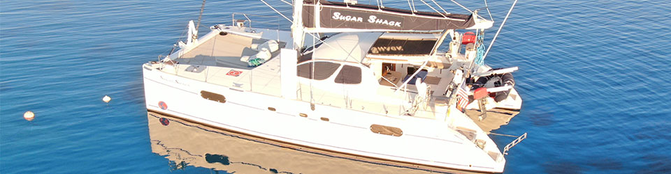
Sugar Shack at Ilot Signal.  Photo Courtesy of Wainani 2026.

Sugar Shack at Ilot Signal. Photo Courtesy of Wainani 2026.

All the Rare Things of Burgess Island

The only island that humans can visit in the Mokohinau Island chain is Burgess Island.  It is the northernmost island of the group and is known for its lighthouse.

The Department of Conservation owns and runs most of the island as a nature preserve and wildlife sanctuary.

Unique species

Because of their isolated location at the edge of the continental shelf, the Mokohinau Islands are home for unique wildlife species found nowhere else in New Zealand, or the world.

The Mokohīnau Islands Nature Reserves provide a safe refuge for some of New Zealand’s smallest endangered species including:

  • Mokohīnau skink
  • Robust skink,
  • Mokohīnau stag beetle,
  • Several threatened plants.
  • Several species of burrowing and ground-nesting seabirds find refuge on the islands, as do a range of forest birds.

To be honest, none of these critters are particularly beautiful, but they are rare and endemic to these islands.

All exotic animal pests have been removed from the island group and the habitats are regenerating naturally. 

The Burgess Lighthouse

The 14 meter lighthouse on Burgess stands at 53 meters above sea level and was first lit in 1883!  The lighthouse, and three keepers cottages were built in 1882.

The keepers originally used oil to power the lighthouse. 

But later the Kiwis converted it to a diesel-generated electricity lighthouse in 1939.

During WWII the navy constructed an early warning radar station near the lighthouse.

The Maritime department automated and “de-manned” the lighthouse in 1980.  Vessels can see it 19nm (35 kilometers) out at sea where the light flashes every 10 seconds.

View from sea as we approach the islands.

View of the lighthouse from the dinghy

In 1996, New Zealand removed the original light and associated equipment and replaced it with a rotating beacon fitted with a 35-watt tungsten halogen bulb.  Solar panels now power the light at the lighthouse.

Today, you can see the lighthouse, the keepers cottages, the radar warning system, an oil store, and the remains of the landing jetty.

I found this interesting post on Burgess Island – check it out.

Unfortunately for us the swell was coming in pretty strong so we could not land the dinghy on Burgess Island. 

I was so disappointed but the “dinghy landing” looked sketchy and had a “danger” sign and the beach was all rocks.

Kiwi Ingenuity

This is a great story of Kiwi ingenuity. 

The keepers had problems getting stores (provisions) in the early years.  The ships only came out 3 times a year and were often very late.

In 1908, one of the keepers built a tin boat with tin sails and dropped 3 letters inside it.  On the outside of the boat were instructions to whoever found the boat.

The Maritime sent the stores ship out within 9 days of the tin boat leaving the Mokohinau Islands!

The original tin boat is on display as the “smallest mail boat in the world” at the Auckland Museum.

Astounding Beauty

We were not able to walk to the lighthouse but we did dinghy all around the Mokohinau Islands.  There are loads of caves and tunnels.

Just check out the many vibrant colors in the water and on the rocks!

Towering cliffsides and mountains jet up from the sea so powerfully.

Every turn showed us something more beautiful.

We were tucked away in a little bay near Hokoromea Island. 

This is by far the best anchor spot in all of the Mokohinau Islands.

But as you can see you have to search for a little sandy spot to drop the hook.

The Mokohinau islands are stunning.  However, you do have to have ideal weather conditions in order to anchor here. 

We were probably on the verge of not good conditions which is why we could not go to shore.  However, it was worth it just to be in the midst’s of so much beauty.

Our blog posts run 6-8 weeks behind actual live events.

We were in the Mokohinau’s in early April 2026.

Find Burgess Island on No Foreign Land.

Be sure to check out our blog post on the Mokohinau Islands.

Murchison, Westport and a Swing Bridge

Our destination today is Westport, but we stop several times on along the way.  About an hour into our drive we pull over at the Hope Saddle Lookout.  We knew we would have wonderful views as we had been winding all around the mountains and through the forest.  The clouds were hanging low and dancing around the peaks.

This spot is famous for saving over 30,000 hectares of forest as the NZ government made an accord with the logging companies.

A sweet little church popped up seemingly out of nowhere.

Murchison and NZ Longest Swing Bridge

We arrive into Murchison which is the home to New Zealand’s longest swing bridge.  It is 110 meters long and is suspended 172 meters high over mighty the Buller Gorge.

We were lucky, there were not a lot of tourists here when we arrived.  We paid $10NZD per person and eagerly headed toward the bridge.  It was a fairly calm day, not a lot of wind so the only swinging came from our own weight.

The views were beautiful from the center of the bridge.

When we got to the other side, we discovered several trails that led to a beach and Ariki Falls.  Super easy walks that led us to beautiful places.  The top left photo shows the flood mark in 2021 – check out the white arrow – it is well over 2.5-3 meters tall.

The Ariki Falls were a really nice diversion and oh so pretty.

This is also where they did a lot of gold mining in this location.  They had a replica of a house used by the miners.

Westport

We arrive into Westport about 6 hours after we left Nelson.  It is a nice little beach town.

We enjoy a nice lunch at Donaldo’s and then head to Carters Beach Seaside (our hotel).  Next we drop our bags and make our way to the beautiful, and very long black sand beach.

We then head to Cape Foulwind where there is a nice hike to a lighthouse.  Yep, you read that right, “Cape Foulwind” and it is very obvious why this town got its name once you arrive….yuck!

This photo shows the original wooden lighthouse that was built in the late 1800’s and to the right is the newer digital, unmanned lighthouse.  I like the original one better.

Pretty views from the base of the lighthouse.

Just 5km down the road is the famous seal colony located in Tauranga Bay.  To my surprise, there really weren’t that many seals – maybe they were all out hunting.

We ended our day with a bottle of rose on the beach at sunset.  I’d say this was a good day!

  • Travel:  210km
  • Hotel: Carters Beach Seasisde

Events from this blog occurred during the last week of February.  Our blog posts run 10-12 weeks behind live events.  Check out the Abel Tasman Caves in our last blog post.