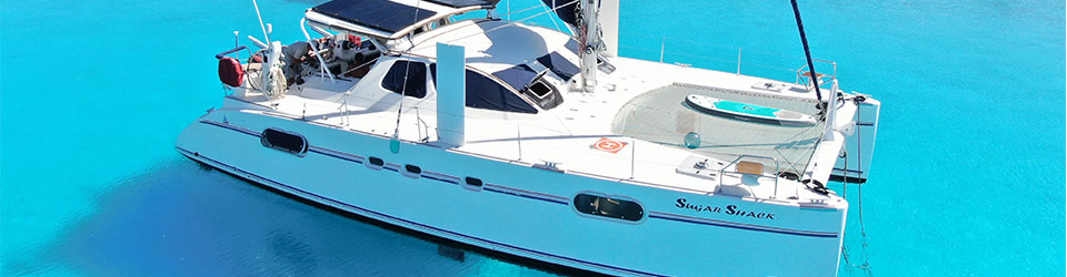
We have slowly been making our way North as we continue to explore the Northland area of New Zealand. There are so many beautiful islands, motus and bays that one could explore the Northland for months and still not see everything.
Since we only had 3-3.5 months of sailing around NZ we decided to focus on the NE side of the North Island (Northland). We played in the blue area.

Cape Brett and Piercy Island
As we head North we pass by Cape Brett and its beautiful lighthouse and the famous Piercy Island (also known as Hole in the Rock). We had super calm conditions with light winds and no swell. There were tons of birds all over the place and they waited until the last minute to scatter on our approach.

We continued on to a small island called Otehei Island which has a beautiful restaurant beach bar. It was super, super shallow on approach so we took it very slow and anchored in 3m of water (that’s pretty shallow, even for us). But we went ashore and enjoyed a tasty lunch as we watched the people and enjoyed the beach.

There was some really bad weather forecasted so we headed into the Bay of Islands the next day.
Bay of Islands
We only planned to stay in the Bay of Islands for a few days as there is a known barnacle problem here. After spending so many days cleaning our bottom we did not want to have to do it again. But, there was no “safe” place for us to go with these predicted winds so we decided to go into the marina at Opua. The only reason we are here is to meet with a few vendors.
We arrived on Sunday afternoon and tied up in our slip. We met with Kim at Masterpieces in Canvas who is doing a few more projects for us. We also met with Roger at North sails who did a free evaluation of our sails and we met with Matthew Duckett our sparky. We also were able to do several loads of laundry, dump our trash and recycling and get a provision run. The weather did come and we saw 38kts of wind and lots of rain. So, we hunkered down inside our little cave. All in all a super productive 3 days in the marina.

We were anxious to leave the marina, mainly because of the barnacles. After leaving the dock, we headed North to continue our Northland adventures. We are trying to make our way to Whangaroa but first we stopped at the famous Cavalli Islands.
Cavalli Islands
Many cruisers and locals told us that the Cavalli Islands are a must see. We did not start looking at anchorages until we were 15nm away from the Cavalli islands. Probably not our best move. What we found was that there is only 1 official anchorage, strange. Well, we found another one at Motukawanui Island. We anchored at Waiiti Bay and it was lovely. We had it all to ourselves.

Waihinepua Bay
We anchored at 34°59.802S / 173°48.969E in 5m of mud. This is a really protected, pretty, small bay. There is a bach on one side but not much else here. The sand on the beach was rich and soft giving us a beautiful array of colors.

Love this photo.

Whangaroa Bay
We got lucky and were able to use a friend’s mooring located near the Whangaroa Boating Club and Cafe. 35°02.554S / 173°44.775E in 6m. It was a short dinghy ride to shore where enjoyed a nice hike up St. Paul’s Rock.
There are two great hikes in Whangaroa Bay. They are St. Paul’s Rock hike and Duke’s Nose Hike. We do St. Paul’s Rock hike first to warm up to Duke’s Nose Hike.
St. Paul’s Rock track climbs steeply through regenerating manuka bush to the top of a volcanic plug (St Paul’s Rock) with spectacular views of the Whangaroa Harbour. Chains are installed to help you climb the last 30 metres. First we walked up the steep road about 1.5 miles before starting the track which was about 25min straight up 500meters.
The name ‘St Pauls’ was given to this rock in the 19th century due to its domelike similarity with St Paul’s cathedral.
The chains were helpful when scaling the rock wall. Yet, Matt still did the climb in flip flops.
We had some really beautiful views at the top.
Views of the Whangaroa Harbor, marina, and mountains. The lower right photo is a shot of their fish farms which are plenty in this harbor.

Duke’s Nose Hike
Duke’s Nose Hike (kaiaraara-rocks) is literally straight up from the minute you start. But luckily it is a short 45-60 minute incline. You can access the Duke’s Nose Hike from the water at Rere bay (which is what we did) or inland along a 6hr hike from Whangaroa Bay.
The trail starts behind Lane Cove Hut in Rere Bay. You can actually rent out Lane Cove Hut for you and 5 of your friends if you are interested in an overnight.
It sure does look like a nose – or maybe a hawk’s beak?

This trail was pretty cool because someone dug out foot holds using the tree roots which made it a lot easier to climb up and down. Also, DOC (Department of Conservation) installs these diamonds to tell you which trail you are on (they come in many different colors) see bottom right photo.

This trail has two rails that you use to climb straight up (in case you are not a rock climber). Going up was fairly easy but going down was a challenge as you can’t see where to put your feet.

But the views were spectacular. There is a nice reel of me climbing down on our svSugarShack instagram and facebook pages.

Simply breathtaking.

Our blog posts run 10-12 weeks behind actual live events. Adventures in this blog post occurred in early March 2024. Did you read about the amazing bird sanctuary at Tiritiri in our last blog post?